Skip to product information
1 of 1

W&P

I-I A234 Northeast Coast of St. Croix chart by Imray-Iolaire

I-I A234 Northeast Coast of St. Croix chart by Imray-Iolaire

Regular Price $32.00
Regular Price Sale Price $32.00
Sale Sold Out
Tax included. Shipping calculated at checkout.

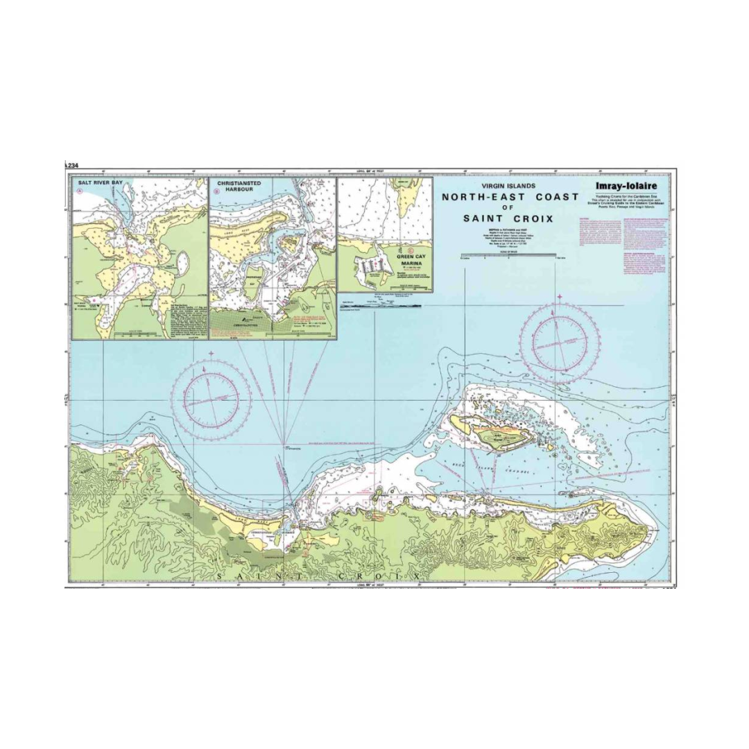
This Imray-Iolaire water resistant chart of the Northeast Coast of St. Croix features large scale insets of Salt River Bay, Christiansted Harbor, and Green Cay Marina. This St. Croix chart is printed in color and uses official surveys and notes based on local knowledge. This Imray-Iolaire passage chart for the Eastern Caribbean is printed in color on treated water-resistant paper.

View full details

Have a question about a product or destination?

Call on us for 40 years experience in charts, navigation, and maritime history.

Call +1-267-773-7858 or Email sales@pilothousecharts.com