
HPC
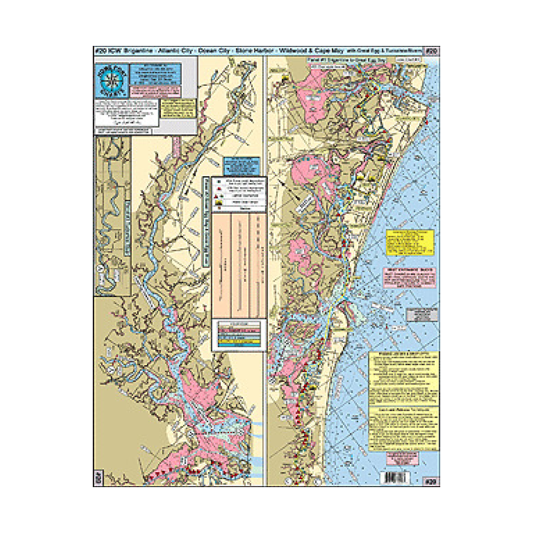
HPC 20 ICW Brigantine, Atlantic City, Ocean City, Stone Harbor, Wildwood, Cape May (with the Great Egg and Tuckahoe Rivers)
HPC 20 ICW Brigantine, Atlantic City, Ocean City, Stone Harbor, Wildwood, Cape May (with the Great Egg and Tuckahoe Rivers)
Couldn't load pickup availability
HPC 20 ICW Brigantine, Atlantic City, Ocean City, Stone Harbor, Wildwood, Cape May (with the Great Egg and Tuckahoe Rivers)
Crabbin' Spots! Great for Kayakers!
*Shows Great Egg Harbor Bay from Garden State Parkway all the way to Mays Landing and the connecting Tucahoe River from Lower Brothers Creek to Rte 50 and 557 in Tucahoe
*Corrected ICW Channels shown in yellow
*Color coded depth and contour curve lines (pink shows 6 ft or less)
*Holes and fishing grounds shown in Back Bays
*Bridges with their Vertical Clearance at mean low water shown
*All lighted markers, buoys, and day markers shown
*All Shore Points and Towns noted
*Laminated - waterproof
*ICW Waterway distances in nautical miles from city to city shown
*Boat Ramps and Marinas shown
Fishing Grounds: Crab Trap Slough, Robo's Hole, Mud Hole, Perch Grounds, The Elbow, The Pig Pen, Paddy's Hole, and many more
Joins Charts:
#1 Delaware Bay
#2 Beach Haven to Cape May to Indian River DE
#6 "Mud Hole" Chart-Sandy Hook to Ocean City NJ
#7 Manasquan to Great Egg inlet out 20 miles
#11 ICW Barnegat-Beach Haven-Atlantic City-Ocean City & Mullica River
Have a question about a product or destination?
Call on us for 40 years experience in charts, navigation, and maritime history.
Call +1-267-773-7858 or Email sales@pilothousecharts.com