
HPC
HPC 2 Beach Haven to Cape May, NJ to Bethany Beach, DE
HPC 2 Beach Haven to Cape May, NJ to Bethany Beach, DE
Couldn't load pickup availability
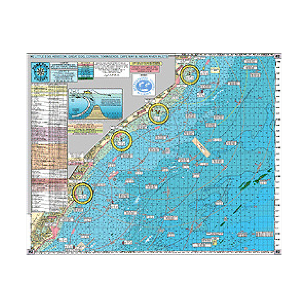
HPC 2 INSHORE- Beach Haven to Cape May, NJ to Bethany Beach, DE
Shows: Little Egg Inlet, Absecon Inlet, Great Egg Inlet, Corson's Inlet, Townsends Inlet, Hereford Inlet, Cape May Inlet in New Jersy to Indian River Inlet in Delaware
OUT 20+ miles with AWESOME BOTTOM STRUCTURE
186+ Wrecks and Reefs
Artificial Reefs Sites: LITTLE EGG REEF- ATLANTIC CITY REEF- OCEAN CITY REEF- WILDWOOD REEF- CAPE MAY REEF- Updated DELAWARE REEF SITES...AND... the new Townsends Inlet Reef!
LOCAL KNOWLEDGE FISHING GROUNDS AND HOT SPOTS NOT FOUND ON OTHER CHARTS: Dog Lump, Hambone, AC Lobster Pots, Triple Lumps, Stone Beds, Cuma Lumps, Table Top, Peacock Lump, Old Grounds, The Valley, Cod Lump, NE Lump, Middle Lump, East Lump, Capt. Steve's Snags, PLUS Brigantine Shoal, Sea Isle Lump, Avalon Shoal, Stone Harbor Lumps, 5 Fathom Bank, Sea Isle Ridge, Fingers, 28 Mile Wreck, AC Ridge, Marylou Slough, South Shoal, Hens and Chickens Shoal, The Valley, McCries Shoal, Triple Wrecks, Fenwick Shoal.
WRECKS: Crystal Gayle, Glory Wreck, Russel, Moran, Astra, Swanaka, Blackie, Florida, Clam Boat, Mud Wreck, Salem, E.B. Cole, Dan's Wreck, Capt Walt Hendee, Bass Barn, D. Barrett, Show Barge, City of Athens, Poseidon, J.R. Williams, China Wreck, King Cobra, F.H. Beckwith, Marley, Sergeant, Tom Tracy, New Orleans, Southern Sword, Cherokee, Gun Boat, Bimbo, Moonstone, Hvoslef, Manhatten, Elizabeth Palmer, Hooter's Barge, Diana Graham, Ferry Elizabeth, Lydia, Guido's Tug, Bay Jack 55 Tug, Donna Star, Margie TTT
* Laminated-waterproof
* color coded depth and contour curve lines
* 5 mile radius lines from every inlet
Joins Charts:
#1 Delaware Bay to the C&D Canal
#6 Mudhole Chart Sandy Hook south to Ocean City, NJ
#7 Manasquan to Townsends Inlet out 20 miles
#10 Tuna Chart Bottom Structure Chart from Barnegat, NJ to Ocean City, MD
#15 Tuna Chart Loran & GPS Cape May, NJ to Ocean City, MD to Chincoteague, VA to Rudee Inlet
#20 ICW Atlantic City to Cape May, NJ with Great Egg Bay & Tuckahoe River
#44 ICW Hereford Inlet to Cape May Harbor Enlargement
Have a question about a product or destination?
Call on us for 40 years experience in charts, navigation, and maritime history.
Call +1-267-773-7858 or Email sales@pilothousecharts.com